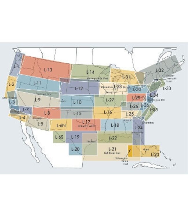
IFR Enroute Low Altitude Charts provide aeronautical information for navigation under instrument flight rules below 18, 000 feet MSL. These four-color chart series includes? Air Traffic Services Airports that have an Instrument Approach Procedure or a minimum 3000' hard surface runway Airways/Route Data Crusing Altitudes Fixes/ATC Reporting Points Limits of controlled airspace Military Training Routes Off Route Obstruction Clearance Altitudes (OROCA) Radio aids to navigation RNAV Routes Special Use Airspace Areas Tabulations (MTRs, SUAs, MOAs, Airport data),>